<Imageotag/>
Imagetag Photos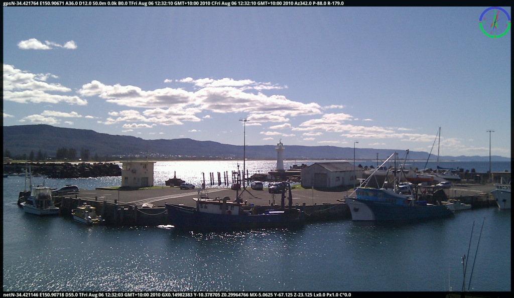
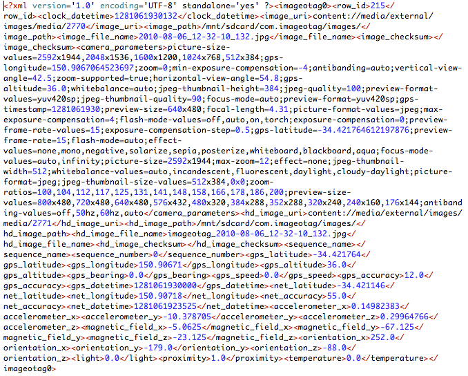
Imageotag creates 16:9 wide screen jpeg camera images and displays around the frame border all available sensor telemetry including GPS latitude, longitude, altitude, accuracy, bearing, speed, date & time, Compass, pitch & roll, clock date & time, network location, accelerometer & magnetic compass as well as proximity, light lux level & temperature.
The sensor details on the top border include-
gpsN-34.421764 E150.90671 A36.0 D12.0 S0.0m 0.0k B0.0 TFri Aug 06 12:32:10 GMT+10:00 2010
GPS latitude, longitude, altitude in meters, accuracy in meters, speed in meters per second and kilometers per hour, bearing in degress, date & time
CFri Aug 06 12:32:10 GMT+10:00 2010
The device Clock date & time
C*320.0 Cm342.0 P-88.0 R-179.0
The device True North Compass, Magnetic Compass, Pitch and Roll in degrees
( Note:
Az342.0 P-88.0 R-179.0
prior to Imageotag V1.0.6 Magnetic Compass was depicted as Az )
The sensor details on the bottom border include-
netN-34.421146 E150.90718 D55.0 TFri Aug 06 12:32:03 GMT+10:00 2010
Network derived latitude, longitude, accuracy in meters, date & time
GX0.1498238 Y-10.378705 Z0.29964766
3D Acceleration X, Y, Z in (earth) gravitation units
MX-5.0635 Y-67.125 Z-23.125
3D Magnetic Compass X, Y, Z in micro tesla units
Lx0.0 Px10.0 C°0.0 Zx0.0
Light level in lux units, Proximity in meters, Temperature in degress celcius and Zoom level where supported
User comment text is also displayed on the right border where entered for a photo.
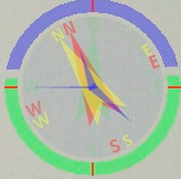 The graphic in the top right corner shows an artifical horizon depicting pitch and roll, clock time, true north compass, magnetic compass and gps bearing heading.
Imageotag also stores the camera, sensor telemetry and photo details for each image into separate xml format files. These xml files are stored in the com.imageotag/xml folder in the device SD card.